How to make maps for your bicycle trips the efficient way ^__^
We will use a bicycle trip planner with GPX route export
For Germany the Radroutenplaner BW is perfect.
You will also need:
MOBAC
OpenStreetMaps HikeBikeMap or CycleMap
and of course... OruxMaps
 First you will need to plan your route
and export the entire route as GPX.
First you will need to plan your route
and export the entire route as GPX.
I won't explain this part because it is pretty straightforward and you can use
any route planner that supports GPX export.
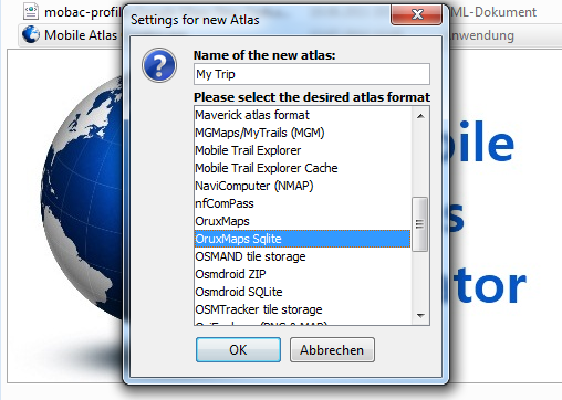
Unzip MOBAC.
Then load up MOBAC and select the
OruxMaps SQLITE Format.
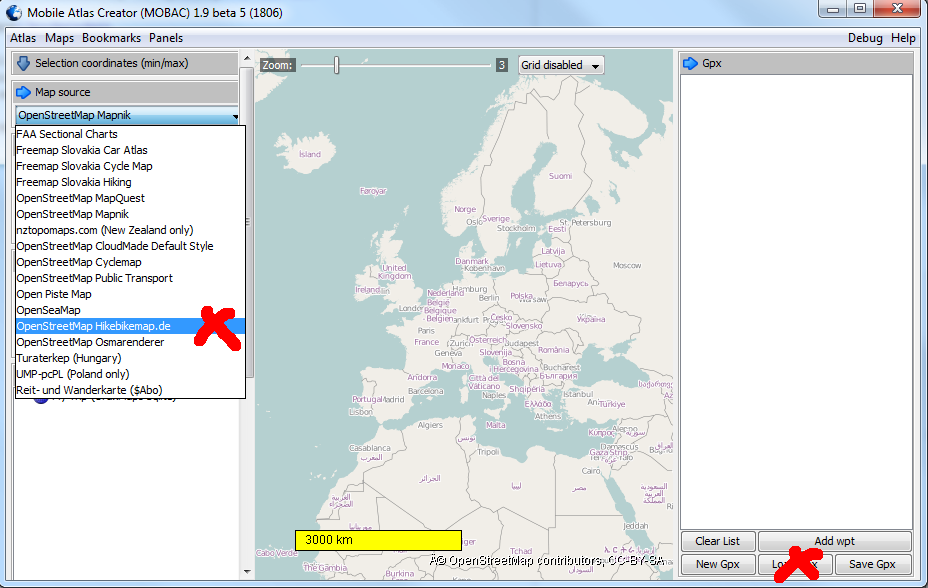
Select your favorite map (I love
hikebikemap ^_^) and load your GPX file

Select your zoom levels. Go ahead...
click all of them. Since you're only
downloading maps along your path, you might as well get the best resolution.
Select a Name for your Layer and then
click on Maps -> Add Selection by GPX
tracks.
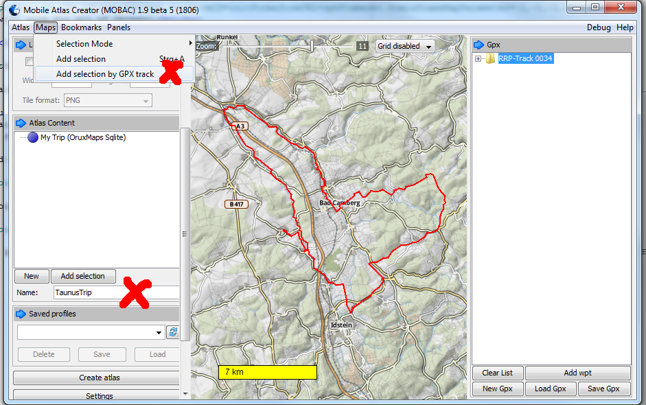
MOBAC will ask you how much distance around your track you want to include.
It's up to you. I always use the max value (768 m) and still end up with nice
small maps.
Now click on "Create atlas" and MOBAC will
download your map.
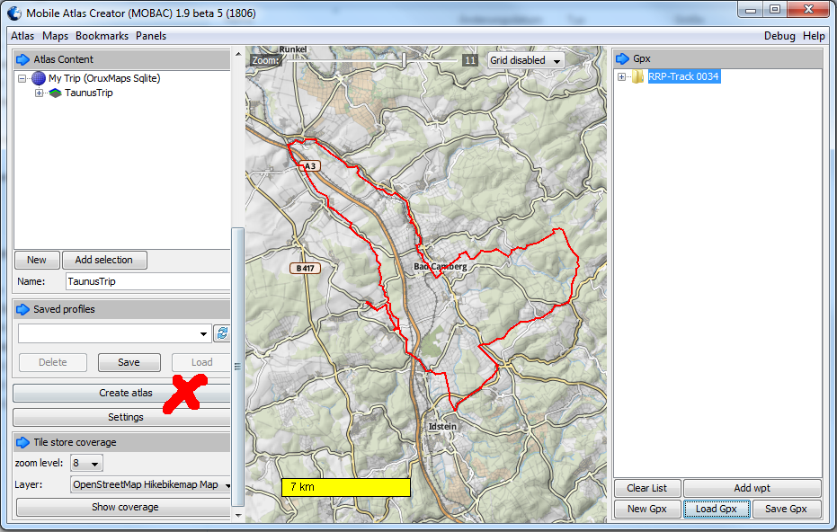
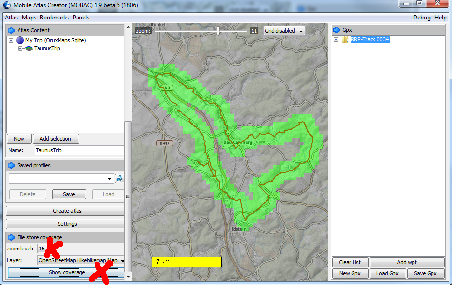
After the download is complete, click on "Show coverage" for a nice
graphical representation of the area of coverage.
Note: this will show the complete area you have downloaded- so after you have
created numerous maps the area will grow to include all of them.
go to the MOBAC atlases directory and copy the subdirectory containing
the .db and .xml files to the oruxmaps/mapfiles directory on your phone.
Have a safe trip!
If you find any errors in this guide or have suggestions, feel free to send an
email to tutorial(AT)wolke7.net.
Thank you Jose Vazquez for your awesome program!